Surveying Instruments
- What are Surveying Instruments?
- Types of Surveying Instruments
What are Surveying Instruments
Surveying Instruments are used for precisely measuring the earth’s surface. Surveying instruments are typically used for large scale outdoor projects from determining property boundaries, preparing construction sites or leveling earth but there are also surveying instruments that are used to measure environmental factors, locate underground services and as safety precautions.
Types of Surveying Instruments
Borescope
A borescope is an optical device that is made up of a flexible or rigid tube with an eyepiece/camera on one end. The camera is linked together by an optical or electrical system in between.
Borescopes are a non-destructive surveying instrument that are used to inspect an object for defects or imperfections without causing any damage. Borescopes are used to inspect industrial systems such as; pipes, heat exchanger tubes, welds, manufactured or machine parts and turbine engines.
GNSS
GNSS stands for Global Navigation Satellite System and is a satellite navigation system that uses small satellites to pinpoint the geographic location of a user’s receiver. The most common type of system to pair with a GNSS is a receiver. GNSS’s are generally used in the survey industry.
GNSS Receivers convert signals from visible satellites into a position on Earth. The number of visible satellites is dependent on the number of satellites the receiver is compatible with.
Multimeter
Multimeters are an essential electronic testing tool that electronic technicians and engineers should own. As its name suggests, it has multiple functions including measuring voltage, current and resistance. It can also be used to test continuity between two points in an electrical circuit.
The use of a multimeter is paramount in order to prevent electrical hazards in industrial warehouses and similar facilities, like short circuiting or wires overheating.

Image credit: Fluke
Theodolite
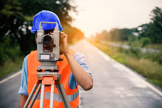
Theodolites are surveying instruments used to measure horizontal and vertical angles in surveying. A theodolite consists of a movable telescope mounted onto axises so it can turn both horizontally and vertically, a spirit bubble and cross hairs in the telescope to allow for accurate alignment of the object sighted.
Thermal Imaging Camera

Image credit: Fluke
A thermographic camera is a device that creates an image using infrared radiation. They work as a heat sensor, as they are highly accurate at detecting tiny differences in temperature.
Typically thermographic cameras are used in fire fighting services and allowing for fire fighters to see through smoke and darkness, however they are extremely beneficial tools in construction industries. For example, they can detect trapped moisture in metal panels, electrical problems such as overloaded circuits, motor bearing failure and electricity distribution.
Total Station
Total stations use electronic transit theodolites in combination with a distance metre to read any slope distance from the instrument to any particular spot.
Total stations can either be manual or robotic. Manual total stations require two people to operate the equipment, one person sighting the prism while the other turns the station. However, a robotic total station is remotely controlled.
Optical Dumpy

Image credit: Topcon
An optical dumpy is an automatic leveling instrument that is used to establish or check points in the same horizontal plane. They work by using a suspended wire compensator and bubble vial through a telescope to find horizontal level measurements.
Optical dumpy's are provide extremely accurate readings and are best for projects where you need extremely precise measurements.


